
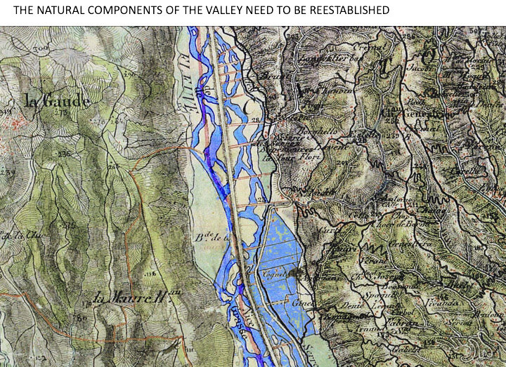
“The strategic Masterplan is about defining clear and compact tranches of development adjacent to tranches of nature and agriculture. A strategic urban node interacts at the bottom of the valley to link it to the continuous ruban of Cote d’Azur. The layout of the guide plan will not let continue the self-distructive strategy of artificially drawling the Var, we will let the river run a natural development.”
Plain of Var


Although it lacks the traditional conditions that spawn economic development (the soil is poor, there is no shipping), in the last decades of the 20th century the Côte d'Azur achieved massive growth – now to the point of saturation – thanks to its exceptional natural beauty, its climate, culture, and the resulting tourism and migration. However, its development was poorly controlled: since 1970, the built substance of the Riviera has grown 142 percent, with a parallel increase in the population of 52 percent – textbook sprawl, resulting in the over-manipulation and degradation of landscapes, a mediocre built environment, and pollution. Today there is a divorce between environmental and economic concerns.


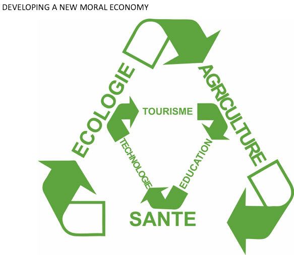
La Plaine du Var, a valley close to Nice designated an OIN (Operation of National Interest) in 2008, is one of the last land reserves of the Cote d'Azur. This area represents a unique opportunity, maybe the last, to rethink the Cote d'Azur. AMO has established a long-term strategy for Plaine du Var that meets the needs of the region by balancing sustainable land use with economic growth. After identifying key issues such as population growth, energy dependence, sprawl, and economic opportunities, AMO proposes for Plaine du Var a new ambition and a new design: the Eco-Vallee.
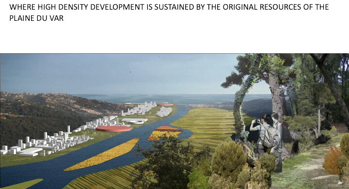
Instead of a thinly distributed urban substance, we propose tranches of development adjacent to tranches of nature, left almost wild, and agriculture. Strategic urban density comes in the form of a circular 'node' at the bottom of the valley: in contrast with adjacent strips of nature, the node is a contained urban with multiple public transport links to the rest of the Cote d’Azur. Meanwhile, rather than continuing the self-destructive strategy of artificially channeling the Var, the river will be allowed to run a natural course.
While Plaine du Var currently has a mostly elderly population, a younger demographic will be attracted by a new campus within the contained urban area, specializing in the health sector. The new urban model for Plaine du Var aims towards energy self sufficiency by harnessing abundant solar power, establishing a smart grid, encouraging recycling in the construction industry, and by diversifying economic activity, improving public transport and reducing travel distances.


credits
Architects : OMA (Clément Blanchet)
Client : Nice Côte d’Azur
Nature of the operation : Definition study
Realised in : 2009
Site : Plaine du Var, Nice, France
Program : Masterplan - mixed used
Budget : not indicated
Exact assignment : associate and coordinating director at OMA
team composition
CVA : Dominique Boudet
Development partners (SETEC Group) : Aurélie Boisselet, Jean-Paul Lebas
Hydratec (groupe SETEC) : Claude Noeuvéglise
BIPE : Elisabeth Waelbroeck-Rocha, Jean-Jacques Enrich, Sofiène Lourimi, Aude Mondon
Werner Zobel Green technologies : Stefan Oelher, Werner Sobek
Ton Matton